THE INNELLAN SEWERAGE SYSTEM "Rock has been replaced in the areas from which it was removed to lay the pipelines ... it is expected that the (movement of the sea) will rapidly bring the beach back to its former condition". Scottish Water, Dunoon Observer, July 29th 2005
Anyone reading this would be forgiven for thinking that the local environment has been returned to the condition in which they found it, or at least the conditions have created the circumstances to allow nature to do that for them.
The following pictures were taken on the 30th July 2005, the day after the press release was published in the local paper. They will allow others to judge the claims. In fact there has ben permanent damage to prats adjoining one of the most important aspects of UK geology, the Highland Boundary Fault which runs through Innellan and which includes areas where Scottish Water has been working.
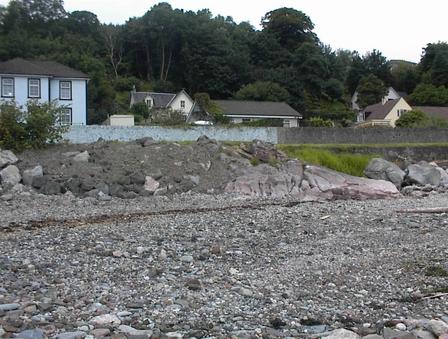
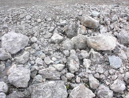
Much of the foreshore is now difficult or impossible to walk along because of the rubble left behind by Scottish Water.What is not clear at this point is who is responsible for the damage, whether it is down to Scottish Water, the contractor Biwater Leslie's execution, monitoring failures by the Council, failures in communication, or some combination of the above.
Click on each thumbnail to get a better view of the herititage left here for future generations
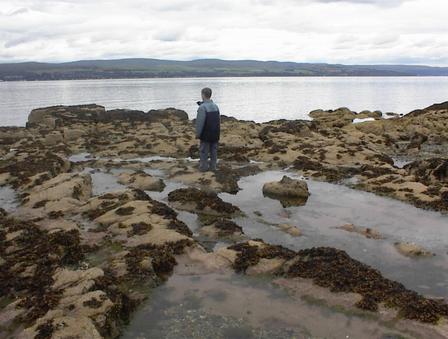
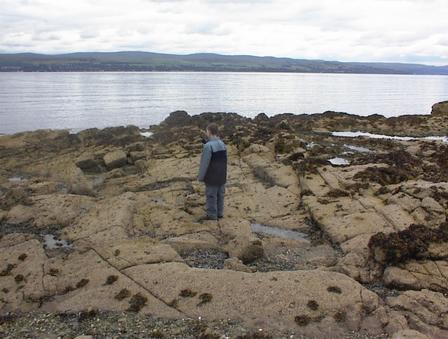
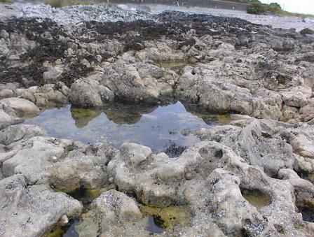
1.Natural rock formation 100 metres south of Ferry Rock...
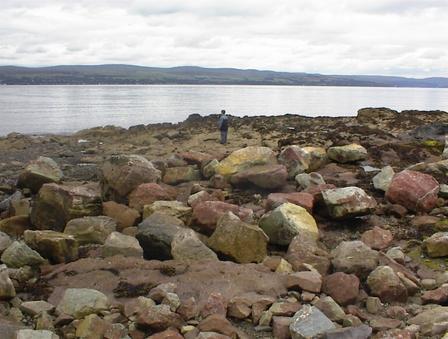
2. ... same place, the view behind of the rubble which Scottish Water has dumped
...
3 ...and the view of that spot with Scottish Water rubble in foreground
4. Second spot, about 80 metres south of Ferry Rock, again natural rock formation, untouched by Scottish Water ...
5... but again this is the view if you turn round and look inland, rubble dumped by Scottish Water ...
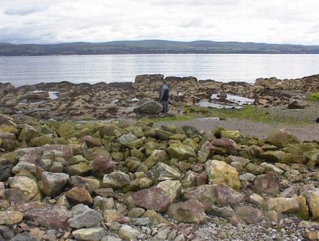
6 ... and here is the view to sea over the rubble
7. This what Ferry Rock looks like now, natural rock in the foreground, Scottish Water rubble in the background ...
8 .. and here is a view of Ferry Rock from the North. Scottish Water alterations on the right
9. This tombstone-like effect is just about all that is left of a sandstone formation (Bowling and Tennis Club foreshore)
10. This is what the south bank of the mouth of the Newton Burn looked like before Scottish Water.
11 .. and this is what it looks like now
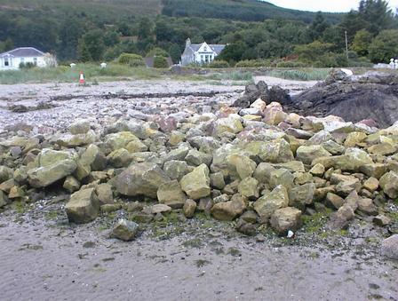
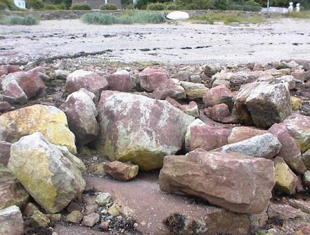
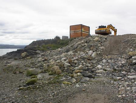
12. A 70 metre long sewage installation near Bowling and Tennis Club
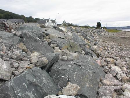
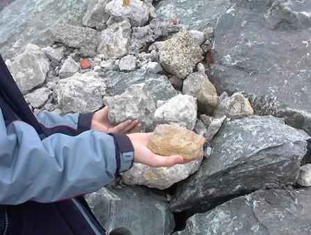
13. This is a close up of the facing on that sewage installation. Building a barrier to protect the sewage tanks against Force 9 Atlantic winter gales? Or building a rock garden?

14. Most of the facing is just loose rubble which can be picked off
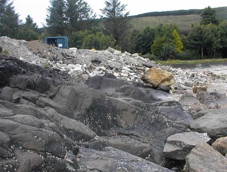
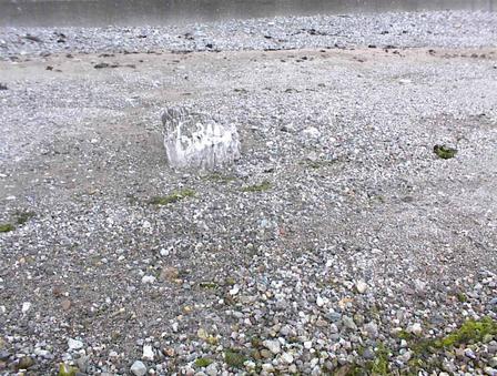
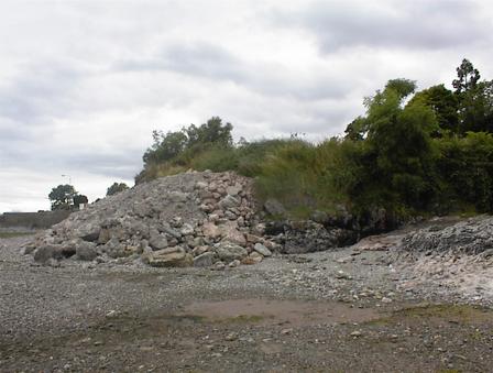
15. This was a (circa) 60 million year old "dyke" formed by volcanic action and subsequent geological and meterological forces, located near bottom of Newton Road. Its stump can still be seen, the rest was amputated by Scottish Water. The rubble is presumably Scottish Water "replacing" the formation. The original was much bigger than this.

16. View of the same amputation and rubble dump from the sea

17 ... and a view from the North
18. One half is original Old Red Sandstone, other half is Scottish Water "replacing" the rock they removed.